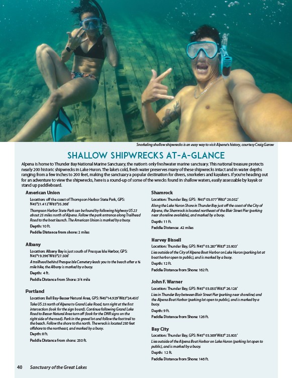
Snorkeling shallow shipwrecks is an easy way to visit Alpena's history, courtesy Craig Gerow
Shallow Shipwrecks At-A-Glance
Alpena is home to Thunder Bay National Marine Sanctuary, the nation’s only freshwater marine sanctuary. This national treasure protects
nearly 200 historic shipwrecks in Lake Huron. The lake’s cold, fresh water preserves many of these shipwrecks intact and in water depths
ranging from a few inches to 200 feet, making the sanctuary a popular destination for divers, snorkelers and kayakers. If you’re heading out
for an adventure to view the shipwrecks, here is a round-up of some of the wrecks found in shallow waters, easily assessable by kayak or
stand up paddleboard.
American Union
Location: off the coast of Thompson Harbor State Park, GPS:
N45°21.412’ W83°35.368’
Thompson Harbor State Park can be found by following highway US 23
about 25 miles north of Alpena. Follow the park entrance along Trailhead
Road to the boat launch. The American Union is marked by a buoy.
Depth: 10 ft.
Paddle Distance from shore: 2 miles
Albany
Location: Albany Bay is just south of Presque Isle Harbor, GPS:
N45°19.396’ W83°27.508’
A trailhead behind Presque Isle Cemetery leads you to the beach after a ¾
mile hike, the Albany is marked by a buoy.
Depth: 4 ft.
Paddle Distance from Shore: 3/4 mile
Portland
Location: Bell Bay-Besser Natural Area, GPS: N45°14.929’ W83°24.450’
Take US 23 north of Alpena to Grand Lake Road, turn right at the first
intersection (look for the sign board). Continue following Grand Lake
Road to Besser Natural Area turn off (look for the DNR signs on the
right side of the road). Park in the gravel lot and follow the foot trail to
the beach. Follow the shore to the north. The wreck is located 250 feet
offshore to the northeast, and marked by a buoy.
Depth: 8 ft.
Paddle Distance from shore: 250 ft.
Shamrock
Location: Thunder Bay, GPS: N45° 03.077’ W83° 26.052’
Along the Lake Huron Shore in Thunder Bay just off the coast of the City of
Alpena, the Shamrock is located northeast of the Blair Street Pier (parking
near shoreline available), and marked by a buoy.
Depth: 11 ft.
Paddle Distance: .42 miles
Harvey Bissell
Location: Thunder Bay, GPS: N45° 03.287’ W83° 25.603’
Lies outside of the City of Alpena Boat Harbor on Lake Huron (parking lot at
boat harbor open to public), and is marked by a buoy.
Depth: 12 ft.
Paddle Distance from Shore: 162 ft.
John F. Warner
Location: Thunder Bay, GPS: N45° 03.050’ W83° 26.128’
Lies in Thunder Bay between Blair Street Pier (parking near shoreline) and
the Alpena Boat Harbor (parking lot open to public), and is marked by a
buoy.
Depth: 9 ft.
Paddle Distance from Shore: 126 ft.
Bay City
Location: Thunder Bay, GPS: N45° 03.369’ W83° 25.605’
Lies outside of the Alpena Boat Harbor on Lake Huron (parking lot open to
public), and is marked by a buoy.
Depth: 12 ft.
Paddle Distance from Shore: 146 ft.
40 Sanctuary of the Great Lakes