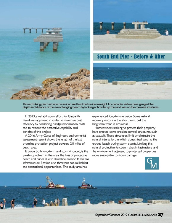
This old fishing pier has become an icon and landmark in its own right. For decades visitors have gauged the
depth and distance of the ever-changing beach by looking at how far up the sand was on the concrete structures.
In 2013, a rehabilitation effort for Gasparilla
Island was approved in order to maximize cost
efficiency by combining dredge mobilization costs
and to restore the protective capability and
benefits of the project.
A 2016 Army Corps of Engineers environmental
assessment report shows the length of the last
shoreline protection project covered 2.8 miles of
beach area.
Erosion, both long-term and storm-induced, is the
greatest problem in the area. The loss of protective
beach and dunes due to shoreline erosion threatens
infrastructure. Erosion also threatens natural habitat
and recreational opportunities. The study area has
South End Pier - Before & After
experienced long-term erosion. Some natural
recovery occurs in the short term, but the
long-term trend is erosional.
Homeowners seeking to protect their property
have erected some erosion control structures, such
as seawalls. These structures limit or eliminate the
natural interaction, in which dunes feed sand to the
eroded beach during storm events. Limiting this
natural protective function makes infrastructure and
the environment adjacent to protected properties
more susceptible to storm damage.
G
M
September/October 2019 GASPARILLA ISLAND 27