106 Chapter Three
• In order to provide a reliable position, the
GPS must be able to receive signals from at
least three of the satellites at the same time.
• The position given from the GPS is displayed
in coordinates called latitude and
longitude that can be plotted on a chart.
Using digital charts for navigation is
called electronic navigation or electronic
charting. Older GPS units display basic
information such as latitude and longitude
of the vessel’s current position, speed
over the ground, courses to waypoints,
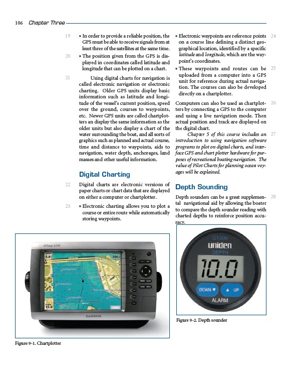
etc. Newer GPS units are called chartplotters
an display the same information as the
older units but also display a chart of the
water surrounding the boat, and all sorts of
graphics such as planned and actual course,
time and distance to waypoints, aids to
navigation, water depth, anchorages, land
masses and other useful information.
Digital Charting
Digital charts are electronic versions of
paper charts or chart data that are displayed
on either a computer or chartplotter.
• Electronic charting allows you to plot a
course or entire route while automatically
storing waypoints.
• Electronic waypoints are reference points
on a course line defining a distinct geographical
location, identified by a specific
latitude and longitude, which are the waypoint’s
coordinates.
• These waypoints and routes can be
uploaded from a computer into a GPS
unit for reference during actual navigation.
The courses can also be developed
directly on a chartplotter.
Computers can also be used as chartplotters
by connecting a GPS to the computer
and using a live navigation mode. Then
actual position and track are displayed on
the digital chart.
Chapter 5 of this course includes an
introduction to using navigation software
programs to plot on digital charts, and interface
GPS and chart plotter hardware for purposes
of recreational boating navigation. The
value of Pilot Charts for planning ocean voyages
will be explained.
Depth Sounding
Depth sounders can be a great supplemental
navigational aid by allowing the boater
to compare the depth sounder reading with
charted depths to reinforce position accuracy.
24
25
26
27
28
Figure 9-1. Chartplotter
Figure 9-2. Depth sounder
19
20
21
22
23