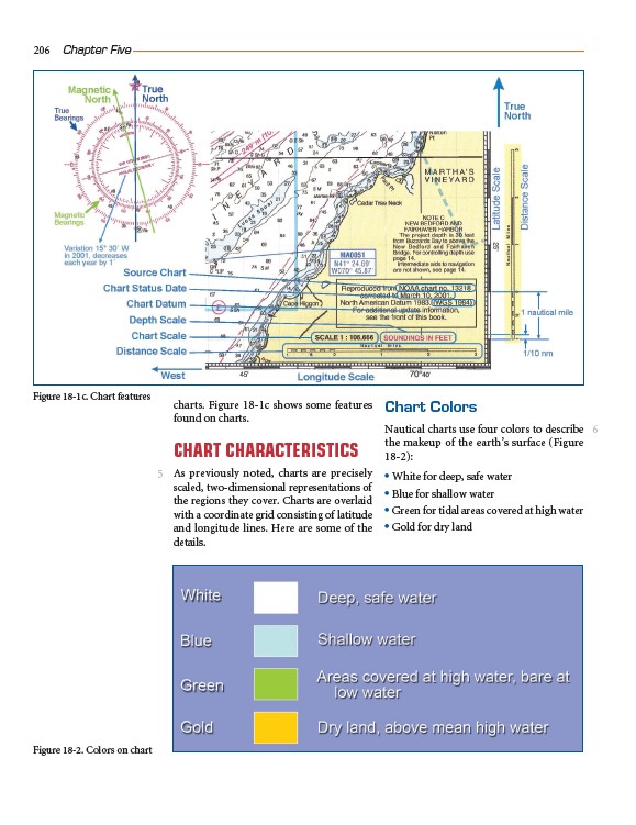
charts. Figure 18-1c shows some features
found on charts.
CHART CHARACTERISTICS
As previously noted, charts are precisely
scaled, two-dimensional representations of
the regions they cover. Charts are overlaid
with a coordinate grid consisting of latitude
and longitude lines. Here are some of the
details.
Chart Colors
Nautical charts use four colors to describe
the makeup of the earth’s surface (Figure
18-2):
• White for deep, safe water
• Blue for shallow water
• Green for tidal areas covered at high water
• Gold for dry land
206 Chapter Five
5
6
Figure 18-1c. Chart features
Figure 18-2. Colors on chart