Space System for Search of Distress Vessels
with Search and Rescue Satellite-Aided
Tracking (COSPAS-SARSAT system
developed by the US, Russia, Canada and
France). Owners / users of EPIRBs fill out
a registration form which is similar to that
used in Rescue 21 when you obtain your
MMSI; specific information about the
owner, passengers and vessel. Each EPIRB
has a serial number code that is digitally
transmitted along with GPS information
(including GPS in your EPIRB purchase is
essential) to the satellites, then processed
by land-based centers to complete rescue
operations
A 406-MHz beacon is offered for
three users: an aircraft unit is known as an
Emergency Locator Transmitter or ELT;
one designed for use aboard a marine vessel
is called an EPIRB; and the unit designed
to be carried by an individual is known as a
Personal Locator Beacon or PLB.
406-MHz beacon is a radio transmitter
that can be activated in a life-threatening
emergency to summon assistance from
government authorities. 406-MHz beacon
does NOT transmit until it is activated in an
emergency (or when certain testing features
are activated by the user). Some beacons are
designed to be manually activated by a person
pressing a button, and some others are
designed for automatic activation in certain
circumstances (e.g. EPIRBs may be automatically
activated by contact with water).
The International Cospas-Sarsat
Program, an intergovernmental cooperative
of 43 countries and agencies, maintains
a network of satellites and ground
facilities to receive distress signals from
406-MHz beacons and route the alerts to
the proper authorities in more than 200
countries and territories. 406 MHz is the
radio-frequency band in which the beacons
transmit and is the band monitored
around the Earth by Cospas-Sarsat.
User activates beacon. When your EPIRB is
activated it begins to transmit a series of very
short, digitally-coded signals (“bursts”) that
indicate that you are in distress. Though
the bursts are kept short to prolong the life
of the beacon battery, each burst sends a
message that identifies the beacon, and may
include information about your aircraft or
vessel, and your location if that information
is available from a navigation device in the
beacon or attached to it.
146 Chapter Three
148a
148b
149
150
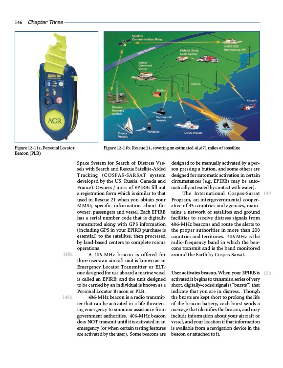
Figure 12-11a. Personal Locator
Beacon (PLB)
Figure 12-11b. Rescue 21, covering an estimated 41,871 miles of coastline