196 Chapter Five
44
45
46
47
48
49
50
51
52
53
54
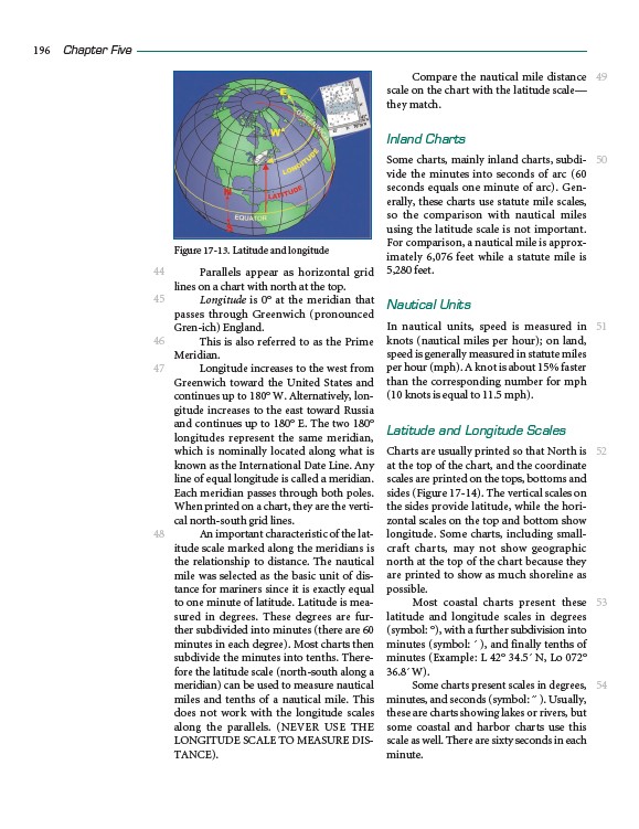
Parallels appear as horizontal grid
lines on a chart with north at the top.
Longitude is 0° at the meridian that
passes through Greenwich (pronounced
Gren-ich) England.
This is also referred to as the Prime
Meridian.
Longitude increases to the west from
Greenwich toward the United States and
continues up to 180° W. Alternatively, longitude
increases to the east toward Russia
and continues up to 180° E. The two 180°
longitudes represent the same meridian,
which is nominally located along what is
known as the International Date Line. Any
line of equal longitude is called a meridian.
Each meridian passes through both poles.
When printed on a chart, they are the vertical
north-south grid lines.
An important characteristic of the latitude
scale marked along the meridians is
the relationship to distance. The nautical
mile was selected as the basic unit of distance
for mariners since it is exactly equal
to one minute of latitude. Latitude is measured
in degrees. These degrees are further
subdivided into minutes (there are 60
minutes in each degree). Most charts then
subdivide the minutes into tenths. Therefore
the latitude scale (north-south along a
meridian) can be used to measure nautical
miles and tenths of a nautical mile. This
does not work with the longitude scales
along the parallels. (NEVER USE THE
LONGITUDE SCALE TO MEASURE DISTANCE).
Compare the nautical mile distance
scale on the chart with the latitude scale—
they match.
Inland Charts
Some charts, mainly inland charts, subdivide
the minutes into seconds of arc (60
seconds equals one minute of arc). Generally,
these charts use statute mile scales,
so the comparison with nautical miles
using the latitude scale is not important.
For comparison, a nautical mile is approximately
6,076 feet while a statute mile is
5,280 feet.
Nautical Units
In nautical units, speed is measured in
knots (nautical miles per hour); on land,
speed is generally measured in statute miles
per hour (mph). A knot is about 15% faster
than the corresponding number for mph
(10 knots is equal to 11.5 mph).
Latitude and Longitude Scales
Charts are usually printed so that North is
at the top of the chart, and the coordinate
scales are printed on the tops, bottoms and
sides (Figure 17-14). The vertical scales on
the sides provide latitude, while the horizontal
scales on the top and bottom show
longitude. Some charts, including smallcraft
charts, may not show geographic
north at the top of the chart because they
are printed to show as much shoreline as
possible.
Most coastal charts present these
latitude and longitude scales in degrees
(symbol: °), with a further subdivision into
minutes (symbol: ´ ), and finally tenths of
minutes (Example: L 42° 34.5´ N, Lo 072°
36.8´ W).
Some charts present scales in degrees,
minutes, and seconds (symbol: ´´ ). Usually,
these are charts showing lakes or rivers, but
some coastal and harbor charts use this
scale as well. There are sixty seconds in each
minute.
Figure 17-13. Latitude and longitude