Section 18: Charts 205
Section 18: Charts
On land you use maps to navigate, usually
along defined roads with the aid of
signposts, lane markers, and road signs. On
the water, seemingly, you can go anywhere.
While this may appear to be an advantage,
you need to choose your own paths and
ensure that they are safe for passage. When
you are on the water, you will have few
clues as to your location.
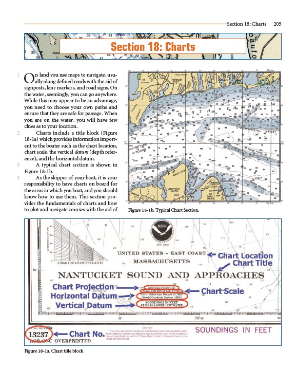
Charts include a title block (Figure
18-1a) which provides information important
to the boater such as the chart location,
chart scale, the vertical datum (depth reference),
and the horizontal datum.
A typical chart section is shown in
Figure 18-1b.
As the skipper of your boat, it is your
responsibility to have charts on board for
the areas in which you boat, and you should
know how to use them. This section provides
the fundamentals of charts and how
to plot and navigate courses with the aid of
1
2
3
4
Figure 18-1a. Chart title block
Figure 18-1b. Typical Chart Section.