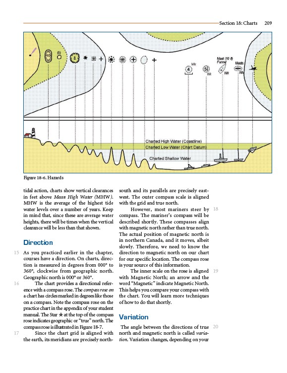
tidal action, charts show vertical clearances
in feet above Mean High Water (MHW).
MHW is the average of the highest tide
water levels over a number of years. Keep
in mind that, since these are average water
heights, there will be times when the vertical
clearance will be less than that shown.
Direction
As you practiced earlier in the chapter,
courses have a direction. On charts, direction
is measured in degrees from 000° to
360°, clockwise from geographic north.
Geographic north is 000° or 360°.
The chart provides a directional reference
with a compass rose. The compass rose on
a chart has circles marked in degrees like those
on a compass. Note the compass rose on the
practice chart in the appendix of your student
manual. The Star ✯ at the top of the compass
rose indicates geographic or “true” north. The
compass rose is illustrated in Figure 18-7.
Since the chart grid is aligned with
the earth, its meridians are precisely northsouth
and its parallels are precisely eastwest.
The outer compass scale is aligned
with the grid and true north.
However, most mariners steer by
compass. The mariner’s compass will be
described shortly. These compasses align
with magnetic north rather than true north.
The actual position of magnetic north is
in northern Canada, and it moves, albeit
slowly. Therefore, we need to know the
direction to magnetic north on our chart
for our specific location. The compass rose
is your source of this information.
The inner scale on the rose is aligned
with Magnetic North; an arrow and the
word “Magnetic” indicate Magnetic North.
This helps you compare your compass with
the chart. You will learn more techniques
of how to do that shortly.
Variation
The angle between the directions of true
north and magnetic north is called variation.
Variation changes, depending on your
Section 18: Charts 209
15
16
17
18
19
20
Figure 18-6. Hazards