are limited. While on the water you will lay
out the directions of sighted bearings and
plot them to help identify your location.
The USPS course plotter represents a good
compromise for use in both locations.
Dividers
Dividers are the second major plotting tool
(Figure 17-11). They are used principally to
measure distances or plot coordinates. The
simplest form consists of two arms ending
in points and joined at the other end with
a friction pivot. Once set, good dividers
will not change their setting without some
moderate effort; this allows you to accurately
transfer a measurement from one
place on the chart to another.
You will mainly be using the latitude
Section 17: Introduction to Navigation 195
and longitude scales and possibly the distance
scale as references for your dividers.
Accuracy is important. On a 1:80,000
scale chart, your pencil line width on the
chart can represent over a hundred feet on
the water.
Generally, you will be asked to strive
for course lines drawn with a sharp, medium
soft pencil to an accuracy of 1° of
angle and one tenth of a nautical mile in
distance.
Latitude and Longitude
What is generally most important and useful
to a boater is direction and distance. The
coordinate system may appear cumbersome,
but it is necessary to communicate
between your GPS and your chart. Latitude
(abbreviated “L”) and longitude (abbreviated
“Lo”) provide an address unique to a
specific location on the Earth.
Latitude is measured either North
or South from the Equator. Longitude
is measured either West or East from the
meridian that passes through Greenwich,
England.
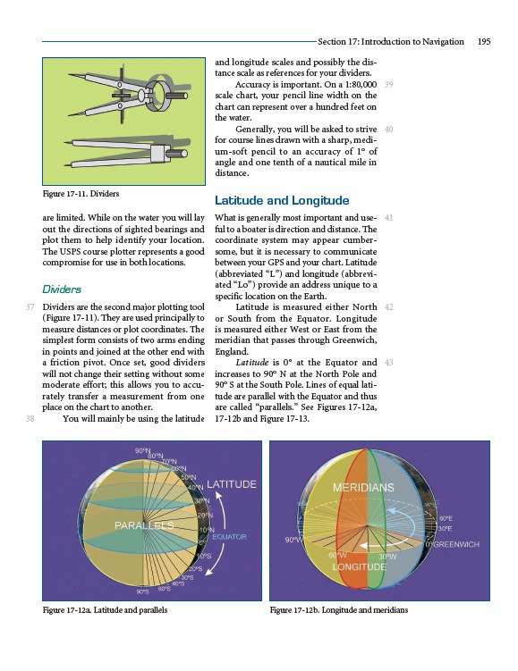
Latitude is 0° at the Equator and
increases to 90° N at the North Pole and
90° S at the South Pole. Lines of equal latitude
are parallel with the Equator and thus
are called “parallels.” See Figures 17-12a,
17-12b and Figure 17-13.
37
38
39
40
41
42
43
Figure 17-11. Dividers
Figure 17-12a. Latitude and parallels Figure 17-12b. Longitude and meridians