A B
C D
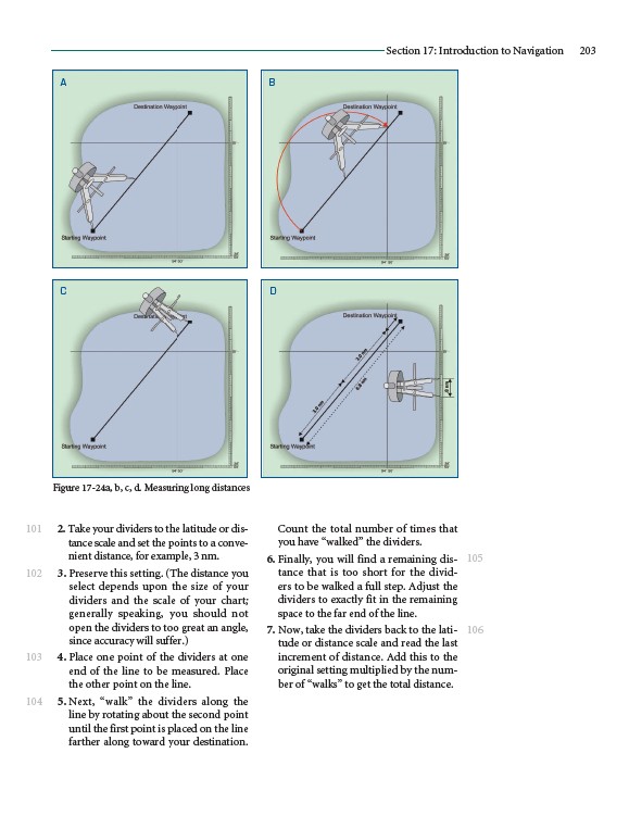
2. Take your dividers to the latitude or distance
scale and set the points to a convenient
distance, for example, 3 nm.
3. Preserve this setting. (The distance you
select depends upon the size of your
dividers and the scale of your chart;
generally speaking, you should not
open the dividers to too great an angle,
since accuracy will suffer.)
4. Place one point of the dividers at one
end of the line to be measured. Place
the other point on the line.
5. Next, “walk” the dividers along the
line by rotating about the second point
until the first point is placed on the line
farther along toward your destination.
Section 17: Introduction to Navigation 203
Count the total number of times that
you have “walked” the dividers.
6. Finally, you will find a remaining distance
that is too short for the dividers
to be walked a full step. Adjust the
dividers to exactly fit in the remaining
space to the far end of the line.
7. Now, take the dividers back to the latitude
or distance scale and read the last
increment of distance. Add this to the
original setting multiplied by the number
of “walks” to get the total distance.
101
102
103
104
105
106
Figure 17-24a, b, c, d. Measuring long distances