you will need to find a safe path to reach
that destination. Because of potential
obstacles, this is likely not to be a straight
line, but rather a sequence of straight lines
called legs (Figure 17-5b). These legs are
plotted to avoid land, shallow water, and
other underwater obstacles along the way.
The end point of each leg is marked by
what is known as a “waypoint.”
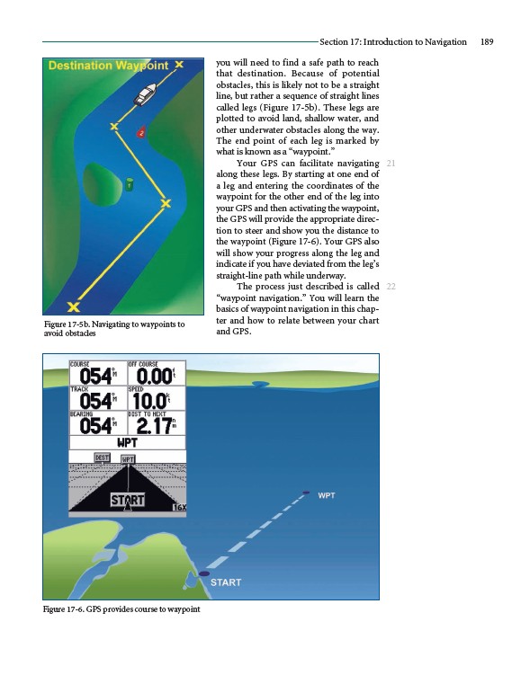
Your GPS can facilitate navigating
along these legs. By starting at one end of
a leg and entering the coordinates of the
waypoint for the other end of the leg into
your GPS and then activating the waypoint,
the GPS will provide the appropriate direction
to steer and show you the distance to
the waypoint (Figure 17-6). Your GPS also
will show your progress along the leg and
indicate if you have deviated from the leg’s
straight-line path while underway.
The process just described is called
“waypoint navigation.” You will learn the
basics of waypoint navigation in this chapter
and how to relate between your chart
and GPS.
Section 17: Introduction to Navigation 189
21
22
Figure 17-5b. Navigating to waypoints to
avoid obstacles
Figure 17-6. GPS provides course to waypoint