tion. Called a “waypoint,” any location can
be defined by its coordinates and stored
within your GPS. Then your unit computes
the difference in coordinates from your
location to those of the selected waypoint
to determine direction and distance. Your
GPS does this continuously, so your relative
positions are constantly updated.
The accuracy of GPS can be uncanny,
often providing position to within 10 to 30
feet.
BASIC NAVIGATION
CONCEPTS
Much of navigation is being continuously
aware of where you are. This is particularly
important near shore because many
obstacles may exist both above and below
the water. Knowing where you are on the
chart allows you to assess the proximity of
these obstacles to your current position and
your intended course. In the USPS Piloting
Course, you will learn to use landmarks and
navigation aids to locate your position on
the water and avoid obstacles.
For this chapter, we rely upon your
GPS to provide your current location. In
navigation on the water, it is important to
compare what you see around you with
your chart to be sure where you are and to
check your GPS. One way to do that is to
compare your surroundings visually with
those depicted on the chart. If you proceed
with more piloting programs, you will learn
how to take bearings with a handbearing
magnetic compass to compare features
more precisely; however, an approximate
comparison is a good start. Later in this
chapter you will learn to use a magnetic
compass for steering a course. While reliable,
GPS is not infallible. Also, there are
opportunities for human error in setting
up the GPS or when entering or selecting a
waypoint to navigate toward. Good navigators
always cross check their instruments.
Setting up your GPS and entering waypoints
is beyond the scope of this chapter;
however, you might consider taking the
USPS Using GPS Seminar to learn how to
do that, or consult your user’s manual that
came with the unit.
Piloting helps to answer basic questions,
such as, “Where am I”? and “How do
I get where I want to go”? Unlike mariners
in past ages, today’s boaters have valuable
tools like GPS that answer the first question
with great ease and precision. In order to
answer the second question, you need to use
a chart to plot your current position and the
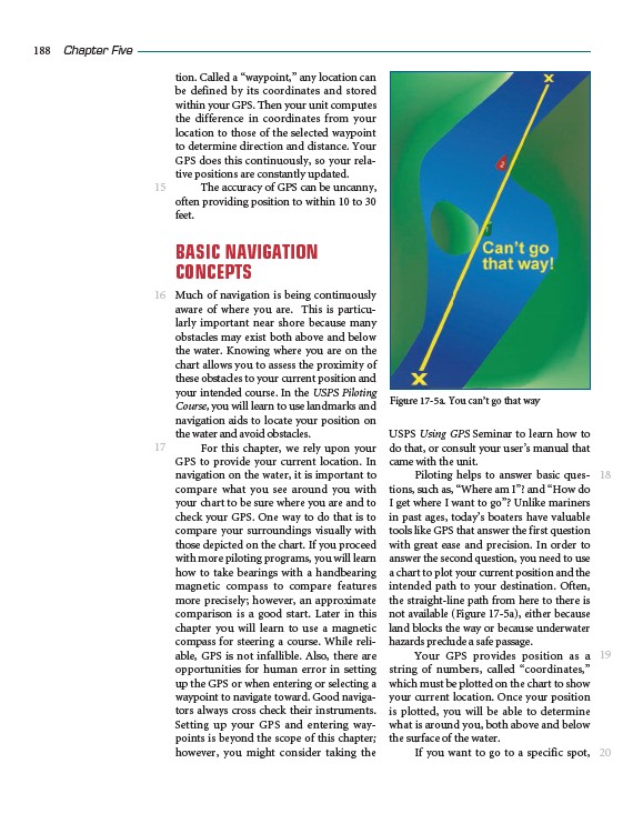
intended path to your destination. Often,
the straight-line path from here to there is
not available (Figure 17-5a), either because
land blocks the way or because underwater
hazards preclude a safe passage.
Your GPS provides position as a
string of numbers, called “coordinates,”
which must be plotted on the chart to show
your current location. Once your position
is plotted, you will be able to determine
what is around you, both above and below
the surface of the water.
If you want to go to a specific spot,
188 Chapter Five
15
16
17
18
19
20
Figure 17-5a. You can’t go that way