Grid Lines
Lastly, and very important to your use of
GPS, charts have grid lines. The grid is laid
out with vertical lines intersecting the poles
of the Earth, called meridians, which run
true north and south and horizontal lines
running east and west called parallels, since
they are parallel to the equator. It is these
grid lines and their intermediate scales that
enable you to compare your GPS coordinates
with the chart.
Chartplotters
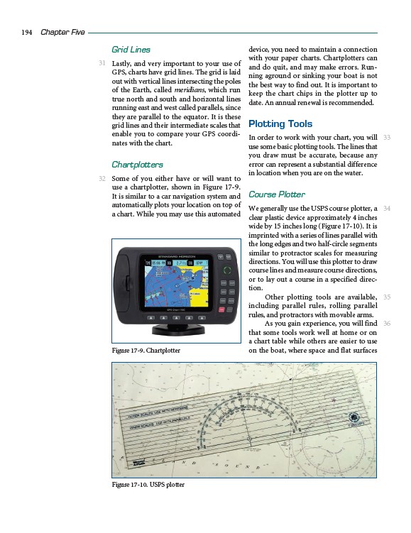
Some of you either have or will want to
use a chartplotter, shown in Figure 17-9.
It is similar to a car navigation system and
automatically plots your location on top of
a chart. While you may use this automated
device, you need to maintain a connection
with your paper charts. Chartplotters can
and do quit, and may make errors. Running
aground or sinking your boat is not
the best way to find out. It is important to
keep the chart chips in the plotter up to
date. An annual renewal is recommended.
Plotting Tools
In order to work with your chart, you will
use some basic plotting tools. The lines that
you draw must be accurate, because any
error can represent a substantial difference
in location when you are on the water.
Course Plotter
We generally use the USPS course plotter, a
clear plastic device approximately 4 inches
wide by 15 inches long (Figure 17-10). It is
imprinted with a series of lines parallel with
the long edges and two half-circle segments
similar to protractor scales for measuring
directions. You will use this plotter to draw
course lines and measure course directions,
or to lay out a course in a specified direction.
Other plotting tools are available,
including parallel rules, rolling parallel
rules, and protractors with movable arms.
As you gain experience, you will find
that some tools work well at home or on
a chart table while others are easier to use
on the boat, where space and flat surfaces
194 Chapter Five
31
32
33
34
35
36
Figure 17-9. Chartplotter
Figure 17-10. USPS plotter