2. Locate the horizontal grid line (parallel
of latitude) nearest to the point
to be measured. Set one point of your
dividers on the point to be measured
and extend the other point directly up
or down to the nearest horizontal grid
line. You will want to preserve this setting.
3. Lift the dividers either by one leg or by
the round thumb pivot at the top and
move them to the nearest latitude scale
on the left or the right side of the chart.
From this step on try not to touch both
legs, as you might accidentally alter
their setting.
4. Place one point on the same horizontal
grid line where it meets the latitude
scale and set the other point along the
scale. Read the latitude by identifying
the degrees (usually printed at only
one location on the scale) and the minutes
(usually numbered at five-minute
intervals on the scale). You can distinguish
individual minutes because most
cartographers mark alternating minutes
with black and white bars.
5. Count the number of minutes (upward
in the Northern Hemisphere or downward
in the Southern Hemisphere)
from the closest numbered minute on
the scale up to but not beyond where
the divider point lies on the scale.
6. Now, count the number of tenths (each
minute will be divided into tenths on
coastal charts) up to the point to be
measured. If the point straddles two
tenth marks, select the one closest to
the point.
7. Write down the latitude in the format
dd° mm.m´ N (or S).
8. Repeat the same process for longitude,
using the nearest vertical grid line
(meridian) for reference.
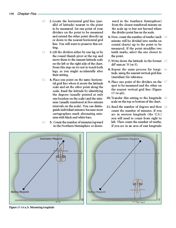
9. Place one point of the dividers on the
spot to be measured and the other on
the nearest vertical grid line (Figure
17-16 a,b).
10. Transfer this setting to the longitude
scale on the top or bottom of the chart.
11. Read the number of degrees and then
count the number of minutes. If you
are in western longitude (the U.S.)
you will need to count from right to
left. Then count the number of tenths.
If you are in an area of east longitude
198 Chapter Five
60
61
62
63
64
65
66
67
68
69
Figure 17-16 a, b. Measuring longitude