Depth
While nautical miles represent an international
standard for distance on nautical
charts, vertical measurements of water depth
and object heights differ. In the U.S., we
measure depths and heights in feet or fathoms.
A fathom is six feet. You will find most
depth contour lines plotted at 6-foot increments
harking back to when the fathom was
a more popular measure. In countries using
the metric system, depths and heights are
plotted in meters.
Projection
Since the world is round and charts are flat,
there is some distortion when we “project”
the earth’s features on a chart. A good
marine chart must maintain accurate depiction
of both direction and distance, at least
across the extent of the chart in use. The
title block on your chart shows the type of
projection and a host of other important
information. Learning the different projections
is beyond the scope of this course.
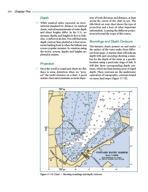
Soundings and Depth Contours
The features charts present on and under
the surface of the water make them different
from maps. A marine chart will indicate
depth with spot soundings showing a number
for the depth of the water at a specific
location using a particular stage of tide. It
will also show corresponding depth contours,
which are lines joining areas of equal
depth. These contours are the underwater
equivalent of topographic contours found
on many land maps (Figure 17-7d).
192 Chapter Five
26
27
28
Figure 17-7d. Chart — Showing soundings and depth contours