CHART BASICS
Charts are your road maps for the water,
but they lack clearly defined highways. You
will need to plot your paths on the water
using information that you get from the
charts. First, you need to understand some
fundamental information about how charts
are constructed.
Scale
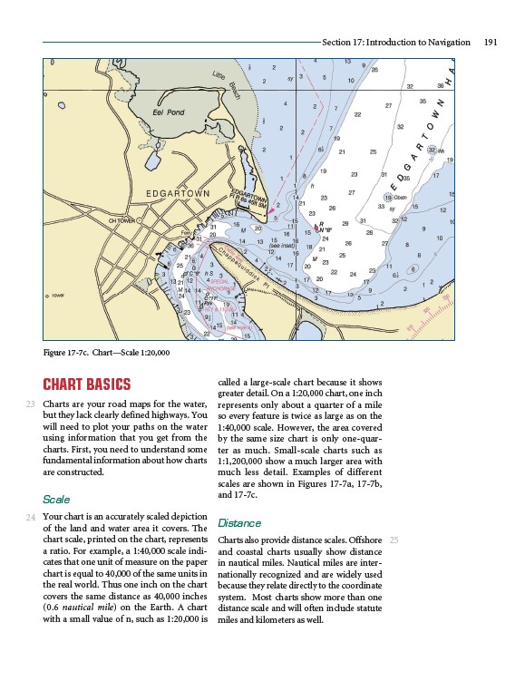
Your chart is an accurately scaled depiction
of the land and water area it covers. The
chart scale, printed on the chart, represents
a ratio. For example, a 1:40,000 scale indicates
that one unit of measure on the paper
chart is equal to 40,000 of the same units in
the real world. Thus one inch on the chart
covers the same distance as 40,000 inches
(0.6 nautical mile) on the Earth. A chart
with a small value of n, such as 1:20,000 is
Section 17: Introduction to Navigation 191
called a large-scale chart because it shows
greater detail. On a 1:20,000 chart, one inch
represents only about a quarter of a mile
so every feature is twice as large as on the
1:40,000 scale. However, the area covered
by the same size chart is only one-quarter
as much. Small-scale charts such as
1:1,200,000 show a much larger area with
much less detail. Examples of different
scales are shown in Figures 17-7a, 17-7b,
and 17-7c.
Distance
Charts also provide distance scales. Offshore
and coastal charts usually show distance
in nautical miles. Nautical miles are internationally
recognized and are widely used
because they relate directly to the coordinate
system. Most charts show more than one
distance scale and will often include statute
miles and kilometers as well.
23
24
25
Figure 17-7c. Chart—Scale 1:20,000